3 Geospatial Web Services Webinars Scheduled

February 16, 2017

webservices

Thursday, Feb. 23, 2:00 PM: Connecting to VCGI Web Services in ArcGIS and QGIS
Presented by Leslie Pelch, Outreach Coordinator at VCGI. Join us to learn how to connect to web map and imagery services provided by the VT Center for Geographic Information. We will cover connecting with both ArcGIS and Open Source software QGIS.
Register here: https://attendee.gotowebinar.com/register/736623693194632706

Wednesday, March 1, 2:00 PM: Geospatial Web Services – A Look Under the Hood
Presented by Steve Sharp, Operations Manager at VCGI. How do Web Map and Imagery Services work? Why are only some data layers available as services, and how are they connected to online mapping apps? Join Steve as he pulls back the curtain on the magic of geospatial web services at VCGI.
Register here: https://attendee.gotowebinar.com/register/7149676994916032770

Thursday, March 9, 2:00 PM: Using VCGI’s NEW Lidar Services in ArcGIS – Hillshade and Digital Elevation Model
Presented by Mike Brouillette, Lidar Program Manager at VCGI. Join us to learn what you can create with the new lidar services in ArcGIS.
Register here: https://attendee.gotowebinar.com/register/6787343932985681922


VT Mapping News: RFP for Parcel Mapping Posted, Bridge and Culvert Data Videos Posted!

January 14, 2015

grantees_2014_2015RFP for Parcel Mapping Posted: 

Lemington today, Brunswick, Stannard, and Sutton coming soon…

I am excited to report that I have posted the first of (at least) 4 parcel mapping RFPs that will be made available in the next month or so: Lemington, VT!

http://vcgi.vermont.gov/about_us/projects/nvpdp

The link for the RFP is near the bottom of the page, but feel free to check the other information about this funded project (which will be done at the end of this year).

youtube_vtransVTrans Youtube Videos of Bridge and Culvert Data Workshop:

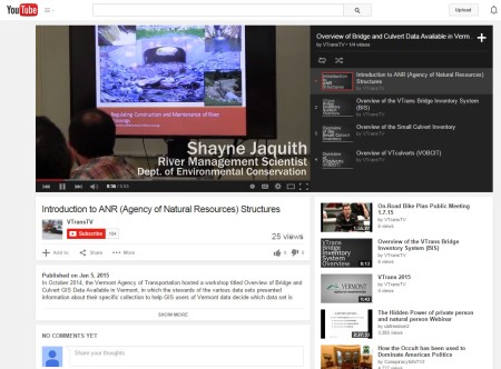
In October 2014, the Vermont Agency of Transportation (VTrans) hosted a workshop to help GIS users of Vermont data understand what bridge and culvert information is available, and which data set is appropriate for their needs.

A series of videos of the information presented at the workshop have been produced by Eric Goldman, Multimedia Specialist, and Sara Moulton, GIS Specialist of the VTrans Division of Policy, Planning and Intermodal Development. The videos can be accessed on YouTube at


VCGI Webinars Scheduled

September 20, 2013
We have 4 webinars scheduled for late October and November. There are three slots open in December if anyone has a topic they would like to present! Dates and times are very flexible, I am just trying to schedule one per week (other than holiday weeks).

Please get in touch if you would like to present or have a suggestion (lesliep@vcgi.org)! In the meantime, check out what we have scheduled so far…

Getting Started with ArcGIS Online for Organizations – Mark Scott, ESRI

Introduction to Quantum GIS (QGIS), Leslie Pelch, VCGI

Quantum GIS: Data Acquisition and Transformation, Leslie Pelch, VCGI

Using GPS and Bringing the Data into GIS, Leslie Pelch, VCGI


VCGI Web Services Expanded – Documentation Posted

February 27, 2013

VCGI, in collaboration with VT’s Enterprise GIS Consortium (EGC), has developed a portfolio of “web services” which allow users to bring map layers and imagery into their GIS projects or map mashups without actually downloading any data. By connecting to the service of choice via the internet (a live internet connection is required in order for the images to appear in your GIS project) users can access a variety of resources.

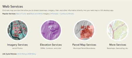
VCGI provides Web Map Services (including a basemap and contours), Imagery Services (black and white, color, infrared, various ages and resolution levels), and Geocoding Services. Services are often available in two forms: 1) cache and 2) non-cache. Cached services (*_CACHE) are designed to be used in browser or mobile web applications which utilize imagery at specific scales and need the fastest rendering performance. Non-cache services (*_NOCACHE) render the imagery to the client application dynamically; this allows clients such as ArcGIS Desktop to ask for the data in different ways (eg: different stretch or band combinations). Many of the services are also available in VT State Plane or Web Mercator projection/coordinate systems.

Services available and information on how to connect is available at the VCGI website: http://vcgi.vermont.gov/warehouse/web_services


Webinars Coming Up: Open Source, Emergency Mapping, VCGI’s New Website, QGIS, Census…

February 15, 2013

Plenty more webinars are scheduled for the next 6 weeks or so! See if any of the topics interest you and register today!


Click on the link below each webinar date for more details and link to registration.


The promise and the reality of free and open-source desktop GIS software

Tue, Feb 19, 2013 1:00 PM – 2:00 PM

http://vcgi.vermont.gov/node/635


QGIS: Creating Map Layouts – Printing and Exporting

Tue, Feb 26, 2013 1:00 PM – 2:00 PM

http://vcgi.vermont.gov/node/636


The New VCGI Website

Tue, Mar 5, 2013 1:00 PM – 2:00 PM

http://vcgi.vermont.gov/node/638


Mapping for Emergency Management (repeat)

Tue, Mar 12, 2013 2:00 PM – 3:00 PM

http://vcgi.vermont.gov/node/639


Mapping With Census Data: Linking Tabular Data From Factfinder2 With VCGI’s Shapefiles

Tue, Mar 19, 2013 1:00 PM – 2:00 PM

http://vcgi.vermont.gov/node/640


Feel free to contact me if you have questions about how a webinar works!


ArcIMS>>>>>ArcGIS Server: January 18, 2013

December 4, 2012

Steve Sharp, VCGI

VCGI is in the process of upgrading its servers and services, and will be phasing out the use of ESRI’s ArcIMS software product over the next month.  This will impact the following VCGI ArcIMS services

  • VGIS_BASEMAP: Dynamic ArcIMS map services with “basemap” features
  • GEOCODE_ESITE: ArcIMS geocoding service using E911 ESITE points

These and all other ArcIMS services will be “turned off” on 1/18/2013.  If you use these ArcIMS services please consider switching to our replacement ArcGIS Server services including

VCGI is working with partners (member of the VT Enterprise GIS Consortium) to implement a robust suite of web services defined in the EGC’s Web Services Strategy.  We hope to have all of these online by the end of 2013.


Leveraging Python to Revolutionize the Production of the Vermont Town Highway Maps

December 4, 2012

 Sara Moulton, VTrans

To put next week’s webinar into context . . .  a reminder that a year ago I sent an email to the VGIS-Listserv asking for feedback about the Town Highway Maps.  The overwhelming response was that people wanted hardcopy versions of the maps.

As a result of this, we worked with the ESRI Holistic Testing Team who devised a new approach to the production of these maps.   A simplified version of the process is available online here

http://www.arcgis.com/home/item.html?id=0ba4fd37e2e54f65b3edf6478e8cc30a

For more information about our actual process and production, tune in to the webinar titled

“Leveraging Python to Revolutionize the Production of the Vermont Town Highway Maps” scheduled for December 12

http://www.vcgi.org/commres/?page=./events/calendar/more_info.cfm&event=Leveraging%20Python%20to%20Revolutionize%20the%20Production%20of%20the%20Vermont%20Town%20Highway%20Maps&cdate=2012%2D12%2D12%2000%3A00%3A00%2E0


An object-based system for LiDAR data fusion and feature extraction

June 12, 2012

Jarlath P. O’Neil-Dunne, UVM Spatial Analysis Lab

An object-based system for LiDAR data fusion and feature extraction is the title of an article headed for publication in Geocarto International, but what it boils down to is our experience doing high-res land cover in Philadelphia.  Before I highlight the key points (who reads anything more that 140 characters anyway?) I did want to thank Sarah Low, formerly with the City of Philadelphia and now with the Forest Service, for all of her help and valuable feedback.  Funding came from ARRA grant, “Restoring Ecosystems in Fairmount Park” (10-DG-11244419-025) ……


For the rest of this article, click here: http://letters-sal.blogspot.com/2012/06/object-based-system-for-lidar-data.html


A Primer for Getting Started With Open-Source Web Maps

June 1, 2012

Bill Morris, Geosprocket, LLC

Now that you know why I care about telling compelling stories with widely-distributed maps, let’s look at a few of the many tools that are out there to help the process. I confess to narrow experience here; I use MapBox and CartoDB for the majority of my projects, and there are plenty of alternatives to those. But as a starting point I think that these open-source web map design platforms are perfect – they minimize the amount of code required, they use the best graphic rendering engine in the field, and they are extremely cheap (or free) to use, even in an enterprise or high-traffic environment. I’m avoiding ESRI’s “ArcWhatever for Server” options because of a.) the high price tag, and b.) the actual user-facing sites are only as robust as the javascript or flash developer who builds them. My preferred options give you a lot more to work with out of the box, for free. Read the rest at Bill’s blog:
http://geosprocket.blogspot.com/2012/05/browser-cartography-some-safehouses-for.html


Browser Cartography: A Manifesto

June 1, 2012

“Toner” tiles by Stamen Design

Bill Morris, Geosprocket, LLC

Hear me out for a minute . . .
. . . I’d like you to make maps intended for online viewing. 

This is partially a selfish impulse; I’m going to throw a rock through the window if I see another “PDF Download” link masquerading as a web map. I’d also like you to do this to save a few trees from their 24″-by-36″-poster fate, but mostly it’s because we’re at an inflection point in cartography . . .

. . . I think the public – the folks who show up to input forums for development projects, and who want to know how far it is to the next lean-to on the trail – are now fully-literate in maps. Mapquest started this process and Google advanced it, but now there are tools beyond those to help you engage your audience on computers and mobile devices (No, Trimble, I am not referring to the Juno. Screw that.). Many of these tools happen to be open-source . . .

See Bill’s blog for the rest of this article: http://geosprocket.blogspot.com/2012/05/browser-cartography-manifesto.html