2017 Orthophoto Acquisition Cut Short

July 6, 2017

VTORTHO_2017_AcquisitionStatusMap_q_sm

How Did The 2017 Spring Collection Go?

The 2017 spring orthophoto acquisition season was challenging. The specifications for Vermont’s orthos require: 1) no snow, 2) no leaves, and 3) no clouds. As you can imagine, this is very difficult to achieve in Vermont. This year was especially difficult. The acquisition area received widespread heavy snow in late March, resulting in persistent snowpack until the middle of April. Flightlines in the Champlain Valley were opened on April 13th, with additional lines opened on the 17th. Unfortunately weather conditions precluded acquisition. All remaining lines were opened on April 20th. The first successful flights were on April 23rd, which captured approximately 50% of the acquisition area at 30cm. The acquisition contractor made a final push on April 27th and 28th to capture additional lines (both 15cm and 30cm) with limited success. All flight lines were closed by VCGI on May 1st due to leaf-out conditions, which was one of the earliest closures in recent memory. The acquisition contractor is processing the imagery and will have preliminary data ready for review by June.

So What Was Collected In 2017?

The blue areas were collected at 30cm GSD. The green areas were collected at 15cm GSD. A large portion of Addison County and the eastern third of the 2017 acquisition area was not acquired in 2017 (shown in yellow). Most 15cm buy-up areas were not collected in 2017. Click here for a PDF map of 2017 orthophoto acquisition.

When Will These Areas Be Collected?

VCGI is currently working with our contractor to draft a plan for future acquisition of the areas not collected in 2017. We will let everyone know what the plan is when it is completed.


More Lidar Services!

June 23, 2017

aspect_service_sm

VCGI is pleased to announce the rollout of more lidar image services covering all or parts of Addison, Bennington, Chittenden, Franklin, Grand Isle, Lamoille, Orleans, Rutland, Washington, Rutland and parts of Caledonia and Orange Counties. The remaining area should have services by the end of 2017. The links below will take you directly to the Rest Endpoint Page for each service. If you are not sure what to do with a Rest Endpoint Page, check out our help video on the topic:

IMPORTANT NOTES:

  • VCGI is aware that both slope services descriptions erroneously refer to the service units as “degree slope”, when in fact they are “percent slope”. Technical issues are blocking our efforts to correct the description.  Thank you for your patience in the meantime.
  • Both the ASPECT and SLOPE image services were intentionally published with the default gray scale color ramp to support flexibility for the user. For details on how you can generate derivatives on the fly using this service, please watch the March 2017 webinar on how to use the new lidar imagery servicesThe Powerpoint used is posted here
  • The ASPECTSYM and SLOPESYM image services were published with pre-determined color ramps (that cannot be changed) to provide users with a “cartographic ready” option.
  • ASPECT and SLOPE data used in these services are not yet completely available for download (soon!)

Vermont GIS Data News

April 14, 2017

okemo_cir_960x300

2016 4-band Ortho Imagery Now Available for Rutland and Windsor Counties!

The new vintage of digital ortho imagery has a base resolution of .3 meters (previously we collected .5 meter) with higher-resolution .15 meter imagery collected in most downtown and village areas. Check this online map for details on higher resolution areas and also which part of the state will be collected each year. The imagery collected in 2016 for the Rutland/Windsor area is now available for download in .jp2 format as well as via image service. Links to download and rest end point are found at the VT Open Geodata Portal. You can also choose to purchase the All Imagery data product (on external drive) if you would like the uncompressed .tif images.

New Lidar Data for Windham, Chittenden, Washington, Lamoille, and Orleans Counties Available!

Not only is newly collected lidar data for a big portion of the state available for download at the Open Geodata Portal (DEM, DSM, and contours), VCGI’s new lidar DEM and hillshade image services are available for the whole state (minus the eastern central portion of the state along the CT River which was collected in the fall of 2016 and should be available late in 2017). All new available lidar (including point clouds, which are not available for download) and their derivatives, as they become available, can be purchased on a single All Lidar external drive as well.

Updated E911 Data Has Been Posted!

E911 data, including esites, driveways, emergency service zones, and other related layers have been updated and posted for download at the VT Open Geodata Portal. More information about what has been posted can be found at the VCGI web site.


3 Geospatial Web Services Webinars Scheduled

February 16, 2017

webservices

Thursday, Feb. 23, 2:00 PM: Connecting to VCGI Web Services in ArcGIS and QGIS
Presented by Leslie Pelch, Outreach Coordinator at VCGI. Join us to learn how to connect to web map and imagery services provided by the VT Center for Geographic Information. We will cover connecting with both ArcGIS and Open Source software QGIS.
Register here: https://attendee.gotowebinar.com/register/736623693194632706

Wednesday, March 1, 2:00 PM: Geospatial Web Services – A Look Under the Hood
Presented by Steve Sharp, Operations Manager at VCGI. How do Web Map and Imagery Services work? Why are only some data layers available as services, and how are they connected to online mapping apps? Join Steve as he pulls back the curtain on the magic of geospatial web services at VCGI.
Register here: https://attendee.gotowebinar.com/register/7149676994916032770

Thursday, March 9, 2:00 PM: Using VCGI’s NEW Lidar Services in ArcGIS – Hillshade and Digital Elevation Model
Presented by Mike Brouillette, Lidar Program Manager at VCGI. Join us to learn what you can create with the new lidar services in ArcGIS.
Register here: https://attendee.gotowebinar.com/register/6787343932985681922


New Interactive Map Viewer Available!

January 23, 2017

imv_html5_sm

The VT Center for Geographic Information (VCGI) is pleased to release a new interactive map viewer that leverages the latest HTML5 capabilities and GIS data. Here are some key features of the new Map Viewer.

Key Features
  • Supported on all modern web browsers on desktop computers, tablets and phones.  No plugins!
  • Save your map via “Save” button (NOTE: must sign-in to ArcGIS Online account first – available for free).
  • Lidar terrain / hillshade data (~50% of the state).
  • Access to VCGI Open Data via a Layer Catalog
  • Download the data layers from the Table of Contents (refer to FAQ for details).
  • Determine when aerial photos were taken (refer to FAQ for details)
  • Change how layers are symbolized so they look the way you want.
  • Export/Print maps to many different formats.
  • Get a street view (Google Street View function).

Check it out here: http://maps.vermont.gov/vcgi/html5viewer/?viewer=vtmapviewer

We hope you enjoy the new VT Interactive Map Viewer! Please direct questions, comments, and suggestions to ACCD.VCGIInfo@vermont.gov.

P.S. The old Microsoft Silverlight Map Viewer will be supported until 3/1/2017 per VCGI’s Life Cycle Policy.


VT Open Geodata Portal Replaces VT GIS Data Warehouse!

January 4, 2017

portal_other

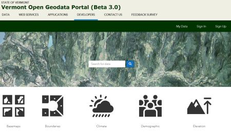
The VT Center for Geographic Information (VCGI) is pleased to announce the release of a new Vermont Open Geodata Portal (geodata.vermont.gov). VCGI, in close collaboration with Vermont’s Enterprise Geospatial Consortium (EGC), has built a website (Portal) that helps constituents find, explore, and access a wealth of geospatial resources. The Portal provides access to geodata, web services, and applications originating from many sources (publishers) including numerous State agencies (e.g. VT Agency of Natural Resources, VT Agency of Transportation, VT Agency of Human Services, VT E911).

Highlights:

  • Download formats – Vector datasets are available in multiple download formats (shapefile, excel, and csv).
  • Smart search – All entries are fully indexed with tags and keywords making it easier to find what you’re looking for.
  • Data visualization – Vector datasets can be visualized using the built-in map viewer. Users can even filter the data before they download it!
  • Big Data download tools – The Portal includes special tools for “big” datasets such as imagery and lidar. These include the Tiled Data Download Tool and Clip & Zip Tool.
  • Modern web platform – The Portal leverages modern web technology supported by Esri (Environmental System Research Institute, Inc.), providing the State with an upgrade path for the future.

VCGI would like to thank our State Agency partners for their ongoing dedication to improving access to Vermont’s geospatial resources!


VCGI Early Winter News

December 19, 2016

geodata1Parcel Data Posted: 39 towns (6 newcomers!) – details here: http://vcgi.vermont.gov/parcels/update_2016A

New Open Geodata Portal Beta Posted: Different CMS, totally different look, still time to provide your feedback via the survey!

Link to BETA 3.0: http://geodata1.vcgi.opendata.arcgis.com/

What do you think?  Check out the site then please filling out this short survey https://www.surveymonkey.com/r/TW92TC6 . The BETA 3.0 site will be available until 5PM 12/21/2016 (Wednesday) so don’t delay!

2017 Intro GIS Training Dates Set: Check the VCGI Trainings Web Page for more details about the trainings that will be offered in partnership with VT Technical College:


Public BETA Release – VT Open Geodata Portal!

November 3, 2016

The VT Center for Geographic Information (VCGI) is pleased to release a BETA version of Vermont’s new Open Geodata Portal!

http://geodata.vermont.gov

VCGI and its partners have built a website that connects publishers and consumers and helps them find, explore, contribute, and use geospatial information and resources. The VT Open Geodata Portal (Beta) “federates” geodata, web services, and geospatial applications from many sources (publishers) including several State agencies (e.g. VT Agency of Natural Resources, VT Agency of Transportation, and VT Agency of Human Services).  VCGI would like to thank our partners for their dedication to improving access to Vermont’s geospatial assets.

What do you think?  Please take a few minutes to explore the BETA site (http://geodata.vermont.gov), kick the tires, and let us know what you think (http://geodata.vermont.gov/beta_survey).  Your input will help us improve the website.  We plan to release a final version by the end of the year.  Thanks!

P.S. Known “bugs/limitations” have been documented here (http://geodata.vermont.gov/beta1_bugs).


Webinars and Workshops Coming Up Over The Next Few Months!

November 1, 2016
buildings_200_400
November 12, 2016 – 9:00 am ArcGIS Online as an Instructional Tool
November 19, 2016 – 9:00 am ArcGIS Online as an Instructional Tool

VCGI Director Chosen

August 8, 2016

Exciting news from Pat Moulton, Secretary of ACCD:

Lucy Leriche and I are excited to announce that John Adams has been selected as the new Director of the Vermont Center for Geographic Information! Most recently, John served as Planning and Policy Manager at the Department of Housing and Community Development within the Agency of Commerce and Community Development.

John brings to VCGI experience and enthusiasm for using data and mapping to guide decision making processes across state government. Since beginning at DCHD in 2012, John has been a leader in land use policy, legislative initiatives and managing special projects – notably using GIS to improve workflows and to ensure Vermont’s public investments are supported by data. He is the primary author of Vermont’s new Planning Manual and has been a key figure in a wide variety of interagency initiatives relating to land use, housing, transportation and energy. As someone with track record of building consensus and commitment to improving customer service in state government, he was the recipient of a 2016 Public Service Recognition Award.

John is a certified professional planner who has worked at the municipal level and has taught Land Use Policy and Economics at the University of Vermont. He holds a Masters of Urban and Regional Planning from Queen’s University and a Bachelor of Arts in Environment and Development from McGill University. In his personal capacity, John volunteers on the Montpelier Planning Commission, roasts coffee and brews beer.

A search committee involving multiple agencies and partners selected John from a pool of incredibly well qualified candidates from around the country. John will start with VCGI on Tuesday, September 9th, 2016.

Please join us in congratulating John on this exciting new position!

Pat