Join us for a Free Webinar on November 5, 10:30 AM – 11:30 AM
Reserve your Webinar seat now at:
https://www3.gotomeeting.com/register/647517934
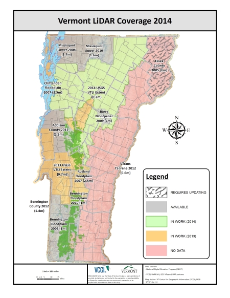
In an ongoing effort to “democratize” access to the wealth of information present in LiDAR data, the Vermont LiDAR Initiative (VTLI) sponsored by the Enterprise Geospatial Consortium (EGC) sub-committee “VTeam LiDAR”, presents the first Vermont LiDAR image service prototype of the 2012 Addison County project area. This freely accessible data “service” will ultimately expand to make all available LIDAR project data accessible in both basemap and imagery services. After a very brief introduction on “What is LiDAR?” we will overview the proposed suite of LiDAR-based Web Services to be created and hosted by VCGI and how it can be accessed by all users. Closing out the webinar, we will provide a brief update on the status of LiDAR data collection and distribution efforts across the state before having an open floor discussion on related topics. For a primer on LiDAR basics before the presentation please overview – http://tinyurl.com/WhatIsLiDAR
More about the VT LiDAR Initiative Here: http://vcgi.vermont.gov/LiDAR


 Posted by VCGI Blog